Blog Post

RAF Targets

  • by Jordan Fadden
  • 24 Apr, 2019

Drawings From The Saltmarsh And Skears

Vibrant colours of the saltmarsh in Summertime, with starlings murmurating across this view of Warton Crag
There's an area roughly one-kilometer out from Jenny Brown's Point in South Silverdale which I recently discovered. It is situated on the edge of the bay and well isolated from any other notable landmarks. Depending on the light and atmosphere, you cannot fail to notice a group of large posts from the shore where people regularly set out on a popular coastal walk. You can see them quite clearly in one of the images from my first blog post titled 'RNLI Callout' standing darkly in the distance like a line of statues keeping watch over the sea. You may also notice them when passing between Carnforth and Silverdale by train, when the vast open space of sky and sea unfolds on one side. Any observers might conclude that "Whatever they are, it's probably too far and inaccessible, or else they're there for that reason alone."
When I first arrived at these mysterious posts, curious to understand more about them, I discovered that they were laid out in the form of a 'V' shape with one at the front, followed by a second single post, then rows of two, three, four and five, forming a triangle. Later I learned from Richard (a local man) that they were once used for target-practice by RAF fighter pilots during WWII. At low water and before incoming tides, it's a fifteen-minute walk before the stream fills. But it can be treacherous. Jenny brown's Point is notorious for its quicksand. So I had taken a much longer route via the mile-long sea wall passing close to the skear - a raised area of rocks protruding out from the sea close to one of the main channels - to get to the salt marsh. On this approach it's often more splashy and you can enjoy the salt water and mud beneath your feet. Otherwise if you wear boots then you can't tell when there may be sinking sand.
The channel at Jenny Brown's Point runs right by the shoreline, but quicksand can be present within a few metres. It's shape and course changes frequently, and sometimes large chunks of sand can be heard crashing into the water from where the sea has carved an edge
It's also possible to visit the skear, but only long before the tide is due in. This area was once part of the ancient Cross-Bay route from Hest Bank to Grange-over-Sands. You'll notice large chunks of land eroded from the saltmarsh. In its epic velocity and reach the sea washes over this land, but only during the big spring tides which rise above nine or ten metres. It's an expansive area consisting of many small pools and ravines which are deep enough to fall into and often too wide to cross. The scale of this grassland can be appreciated from various points on Warton Crag and Heald Brow. At ground level, however, it can be impossible to plot a way through this maze. Some of the large posts still retain their rusty hinges and many are covered by lichen and deep cracks formed in the wood over many moons.
Late evening on the saltmarsh, where sheep graze in the Summer. Drawn on A3 paper using acrylic inks
One of a number of quick sketches of the saltmarsh, keeping close to the edge of the mudflats
Channel at Jenny Brown's Point with edges carved in the mud banks
You must take care not to venture too far as there are lots of nesting birds which can be easily disturbed. There was even a nest built on the top of one of the huge posts, with long sticks dangling out. The 'Eric Morecambe' hide is visible over at the nature reserve. That's an area of freshwater mosses and marsh with dense reed grass across the railway embankment, and it's a place for the wading birds and other wildlife - some rare and endangered - and for breathtaking starling murmurations.

Skear Near Jenny Brown's Point

The word skear generally means 'scar', and there's not many of them on the bay. The small one off the coast at Jenny Brown's Point is separate from the mile-long sea wall originally built for a land reclamation scheme, though it appears very similar in parts since the plan was unsuccessful due to a lack of funding and it was breached by the sea. However, all of these scars of rock now provide the birds with a safe place to roost at High Water. On my initial discovery of the small skear I was able to walk around it and explore the surface. But when I visited again a week later I noticed that the deep channel which separates from the river Kent three-miles North had flooded one side. This is how powerful the Morecambe Bay tides are, with millions of tonnes of sand and mud being shifted continually. Neither this skear nor the next, which is up to an hours walk away and has boulders the size of cars, can provide sanctuary at High Water as the fast rising tide will quickly cover them. It's not unusual to see previously buried skears, boats and cars re-emerge.
The silver sands of Morecambe Bay, which often takes on a pastel-like appearance when viewed from Jack Scout. The small skear is visible on the left side beyond the meandering channel
During my most recent visits to this small skear I had to carefully wade to reach the rocks, and on other occasions it was inaccessible due to the channel widening and making it into an island. Sand gets scoured around the bigger rocks, making it deeper. On the skear itself there are signs of past human activity, and the rocks are more crustaceous and grey from a dense covering of limpets. Wooden stakes and iron posts with netting now twisted and covered in algae and seaweed lay bent from waves and rocks colliding with them. Clearly it was once frequented by fishermen hoping to catch whatever the sea brings in. The sight of a human arm or leg bone suddenly makes this the eeriest place I've ever stepped foot. Many lives have been lost out here, and there are recent reports of human remains washing up. Murmurating oystercatchers lighten the mood. I can never quite comprehend the scale of what occurs twice daily. I'm walking where dogfish and rays will soon be swimming, arriving with the sea from as far away as eight to twelve miles.

Priest Skear

The sheer vastitude of the bay itself reduces even the largest skears to meagre mounds. Here you can find an abundance of interesting objects which lay in its desolate setting. Among which are two vehicles presumed to be the remains from some of the last cockling activity to have taken place out here, when a group of cockle pickers drove out to Priest Skear on that fateful night over fifteen-years ago, never to return. Tragically, nearly all of them were quickly overcome by a fast rising tide. The place has been altered by this event, and the cockle beds left alone for an indefinite period - the cockles left for the oystercatcher to collect and prise open with its long bill or smash against a rock to get inside. One vehicle lies submerged on one side, and another on the opposite side with its steering wheel intact and its engine parts exposed.
The skeleton remains of a vehicle close to where the river Keer runs around the side of Priest Skear
A closer image of the vehicle now covered by algae.
These rusty shells now serve as a warning sign of the inherent dangers of venturing out to such perilous places like this, which was once the beginning of a dangerous crossing undertaken by many hundreds of souls each year, and it's been fished for centuries. There is a group of huge boulders scattered along the sea-facing edge, gradually becoming predominantly green with algae. There may be little sign of the sea approaching from the West, yet water will silently creep in and all around this huge sandbank. Fifteen-minutes of walking will seem much longer when the bore is visible right behind you. Nearby Redbank is a safer place to observe from and offers an impressive panoramic view of the bay. The coastal farm at Redbank has stood here for many centuries and now includes a cafe and caravan site for visitors.
One of the vehicles on the opposite side closer to the boulders. Shot using 50mm Nikkor lens
Ink drawing on A3 paper facing the main channel and Cumbrian mountains. A visit to this place must be very brief.
One of the boulders appearing almost diamond-shaped against the distant flat plain of Morecambe
The same boulder from another angle now appears more like a giant jigsaw-puzzle piece against the distant hill of Warton Crag
Seaweed covers another boulder against the distant Hampsfield Fell & Coniston fells - the place from which it more than likely came
The previous boulder now appears quite distant as Arnside Knott moves into view beyond. Algae and seaweed covers the lower slopes of this rocky skear

RAF Targets

  • by Jordan Fadden
  • 24 Apr, 2019

Drawings From The Saltmarsh And Skears

Vibrant colours of the saltmarsh in Summertime, with starlings murmurating across this view of Warton Crag
There's an area roughly one-kilometer out from Jenny Brown's Point in South Silverdale which I recently discovered. It is situated on the edge of the bay and well isolated from any other notable landmarks. Depending on the light and atmosphere, you cannot fail to notice a group of large posts from the shore where people regularly set out on a popular coastal walk. You can see them quite clearly in one of the images from my first blog post titled 'RNLI Callout' standing darkly in the distance like a line of statues keeping watch over the sea. You may also notice them when passing between Carnforth and Silverdale by train, when the vast open space of sky and sea unfolds on one side. Any observers might conclude that "Whatever they are, it's probably too far and inaccessible, or else they're there for that reason alone."
When I first arrived at these mysterious posts, curious to understand more about them, I discovered that they were laid out in the form of a 'V' shape with one at the front, followed by a second single post, then rows of two, three, four and five, forming a triangle. Later I learned from Richard (a local man) that they were once used for target-practice by RAF fighter pilots during WWII. At low water and before incoming tides, it's a fifteen-minute walk before the stream fills. But it can be treacherous. Jenny brown's Point is notorious for its quicksand. So I had taken a much longer route via the mile-long sea wall passing close to the skear - a raised area of rocks protruding out from the sea close to one of the main channels - to get to the salt marsh. On this approach it's often more splashy and you can enjoy the salt water and mud beneath your feet. Otherwise if you wear boots then you can't tell when there may be sinking sand.
The channel at Jenny Brown's Point runs right by the shoreline, but quicksand can be present within a few metres. It's shape and course changes frequently, and sometimes large chunks of sand can be heard crashing into the water from where the sea has carved an edge
It's also possible to visit the skear, but only long before the tide is due in. This area was once part of the ancient Cross-Bay route from Hest Bank to Grange-over-Sands. You'll notice large chunks of land eroded from the saltmarsh. In its epic velocity and reach the sea washes over this land, but only during the big spring tides which rise above nine or ten metres. It's an expansive area consisting of many small pools and ravines which are deep enough to fall into and often too wide to cross. The scale of this grassland can be appreciated from various points on Warton Crag and Heald Brow. At ground level, however, it can be impossible to plot a way through this maze. Some of the large posts still retain their rusty hinges and many are covered by lichen and deep cracks formed in the wood over many moons.
Late evening on the saltmarsh, where sheep graze in the Summer. Drawn on A3 paper using acrylic inks
One of a number of quick sketches of the saltmarsh, keeping close to the edge of the mudflats
Channel at Jenny Brown's Point with edges carved in the mud banks
You must take care not to venture too far as there are lots of nesting birds which can be easily disturbed. There was even a nest built on the top of one of the huge posts, with long sticks dangling out. The 'Eric Morecambe' hide is visible over at the nature reserve. That's an area of freshwater mosses and marsh with dense reed grass across the railway embankment, and it's a place for the wading birds and other wildlife - some rare and endangered - and for breathtaking starling murmurations.

Skear Near Jenny Brown's Point

The word skear generally means 'scar', and there's not many of them on the bay. The small one off the coast at Jenny Brown's Point is separate from the mile-long sea wall originally built for a land reclamation scheme, though it appears very similar in parts since the plan was unsuccessful due to a lack of funding and it was breached by the sea. However, all of these scars of rock now provide the birds with a safe place to roost at High Water. On my initial discovery of the small skear I was able to walk around it and explore the surface. But when I visited again a week later I noticed that the deep channel which separates from the river Kent three-miles North had flooded one side. This is how powerful the Morecambe Bay tides are, with millions of tonnes of sand and mud being shifted continually. Neither this skear nor the next, which is up to an hours walk away and has boulders the size of cars, can provide sanctuary at High Water as the fast rising tide will quickly cover them. It's not unusual to see previously buried skears, boats and cars re-emerge.
The silver sands of Morecambe Bay, which often takes on a pastel-like appearance when viewed from Jack Scout. The small skear is visible on the left side beyond the meandering channel
During my most recent visits to this small skear I had to carefully wade to reach the rocks, and on other occasions it was inaccessible due to the channel widening and making it into an island. Sand gets scoured around the bigger rocks, making it deeper. On the skear itself there are signs of past human activity, and the rocks are more crustaceous and grey from a dense covering of limpets. Wooden stakes and iron posts with netting now twisted and covered in algae and seaweed lay bent from waves and rocks colliding with them. Clearly it was once frequented by fishermen hoping to catch whatever the sea brings in. The sight of a human arm or leg bone suddenly makes this the eeriest place I've ever stepped foot. Many lives have been lost out here, and there are recent reports of human remains washing up. Murmurating oystercatchers lighten the mood. I can never quite comprehend the scale of what occurs twice daily. I'm walking where dogfish and rays will soon be swimming, arriving with the sea from as far away as eight to twelve miles.

Priest Skear

The sheer vastitude of the bay itself reduces even the largest skears to meagre mounds. Here you can find an abundance of interesting objects which lay in its desolate setting. Among which are two vehicles presumed to be the remains from some of the last cockling activity to have taken place out here, when a group of cockle pickers drove out to Priest Skear on that fateful night over fifteen-years ago, never to return. Tragically, nearly all of them were quickly overcome by a fast rising tide. The place has been altered by this event, and the cockle beds left alone for an indefinite period - the cockles left for the oystercatcher to collect and prise open with its long bill or smash against a rock to get inside. One vehicle lies submerged on one side, and another on the opposite side with its steering wheel intact and its engine parts exposed.
The skeleton remains of a vehicle close to where the river Keer runs around the side of Priest Skear
A closer image of the vehicle now covered by algae.
These rusty shells now serve as a warning sign of the inherent dangers of venturing out to such perilous places like this, which was once the beginning of a dangerous crossing undertaken by many hundreds of souls each year, and it's been fished for centuries. There is a group of huge boulders scattered along the sea-facing edge, gradually becoming predominantly green with algae. There may be little sign of the sea approaching from the West, yet water will silently creep in and all around this huge sandbank. Fifteen-minutes of walking will seem much longer when the bore is visible right behind you. Nearby Redbank is a safer place to observe from and offers an impressive panoramic view of the bay. The coastal farm at Redbank has stood here for many centuries and now includes a cafe and caravan site for visitors.
One of the vehicles on the opposite side closer to the boulders. Shot using 50mm Nikkor lens
Ink drawing on A3 paper facing the main channel and Cumbrian mountains. A visit to this place must be very brief.
One of the boulders appearing almost diamond-shaped against the distant flat plain of Morecambe
The same boulder from another angle now appears more like a giant jigsaw-puzzle piece against the distant hill of Warton Crag
Seaweed covers another boulder against the distant Hampsfield Fell & Coniston fells - the place from which it more than likely came
The previous boulder now appears quite distant as Arnside Knott moves into view beyond. Algae and seaweed covers the lower slopes of this rocky skear

by Jordan Fadden 19 March 2024
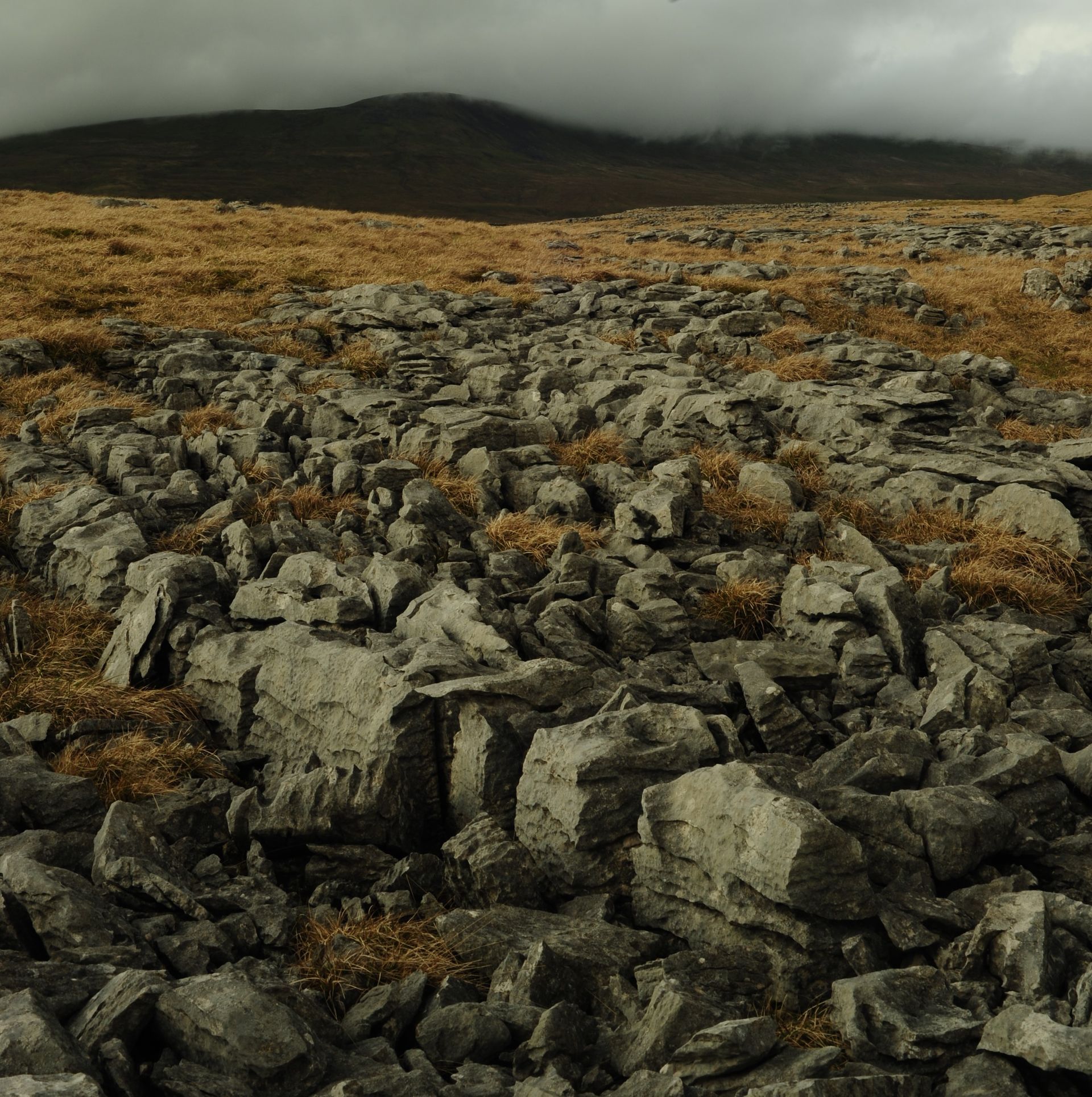
As we move from Winter into Spring time, one place I ventured into for the first time last week was the dramatic moorland region around the North Yorkshire villages of Clapham and Austwick. As you make your ascent on the steep tracks, incredible panoramic views open up across the Forest of Bowland to the south. And as you ascend farther into the Dales you encounter all kinds of interesting boulders, crags, and screes. The distinctive dry stone walls and many field barns confirm that you are well inside the National Park, with streams gushing from the hills and limestone pavement dominating the views of the famous Yorkshire three-peaks once you arrive on high ground. 
by Jordan Fadden 29 January 2024
The smartphone offers an alternative way of drawing and seeing. Even when you're not one for spending very much time looking at little screens, and swiping and tapping and scrolling, the smartphone can still be a useful device if you happen to be without your usual materials. And of course a tablet would be the next step if you was really inclined to using a digital means of sketching, especially if your focus is going to be on landscapes. As small as the touchscreen is, it responds to subtle movements made by the finger or thumb. No app was used here, just the basic photo editor which allows you to make marks over the top. The phone I used was a Samsung Galaxy S8 Edge. Very small compared to most.
by Jordan Fadden 11 January 2024
Thank you for the memories to those whom I met on my journey to the famous lagoon, - in particular Florentina and Theodora who invited me to Padua to show me the sights of this nearby town at night. Tina was a most knowledgeable guide, whilst Dora kept us amused with her hilarious accent. Also, best wishes to Kalina and Milena. I very much look forward to revisiting Venezia in the future. Even though the days are only short, and the weather still quite cold and unpredictable, the light in January is still dazzling as you can see.
by Jordan Fadden 1 December 2023
It felt more like the depths of Winter, rather than the start, during my five-day's of hiking across high land at the end of November. The North Pennines is a vast area, featuring the highest paved roads in the country. And the weather can be more changeable than anywhere else; atop Great Dun Fell there's a radar and weather station specifically for studying the clouds, because here you get the highest amount of precipitation.
by Jordan Fadden 23 October 2023
The following selection of images represents some of my recent travel photography on a visit to the southernmost Greek island of Crete in late September to mid-October 2023. When viewing these pictures, imagine if you can the sound of bells jingling as mountain goats pass across the mountainsides and roads, the loud noise of crickets, the smell of salt air from the Mediterranean and Libyan sea, and of the chatter of the Cretan folk with their warm hospitality as they prepare their wonderful cuisine rich in olive oil and complemented by their drink offerings of raki and retsina. 
by Jordan Fadden 6 June 2023
This is a visual diary in photographs from a few days of hiking and mountain climbing in the English Lake District last weekend. I covered quite a lot of ground from the high mountain of Helvellyn in the East across to the more Westerly mountain of Haystacks before descending in to the Buttermere Valley. It was very lively down by the shores of Lake Buttermere as an annual paragliding event was taking place, with people dropping from aeroplanes and flying off most of the surrounding high peaks before trying to land as close to the target in one of the fields. Some of the participants descended in somersaults leaving colourful trails of smoke behind them. 
by Jordan Fadden 6 April 2023
It is possible to cycle all the way around the Lake District National Park in a day without stopping, and yet despite the modest scale and altitude of these mountains compared to the world's greatest mountain ranges it can still feel extraordinarily remote and wild when you're hiking in the district, with mountain terrain which is just as challenging and impressive as any other. The quality of light and how dramatically the light and shadows shift across the fells here is second to none. This is because it's like a miniature version of any other rugged mountain region. And late last week I hiked across some of the highest peaks including Bow Fell, Scafell Pike, Kirk Fell and Pillar, following a route from Great Langdale to Wasdale and finally on to Borrowdale via Green Gable and Gillercomb.
by Jordan Fadden 21 January 2023
This is a series of photographs shot during a hike in to the mountains earlier this week on a visit to the central and western Lake District. I made my way up to a fell summit called Allen Crags via Sprinkling Tarn and Esk Hause. Many of the steep footpaths were quite treacherous due to the ice, and the snow on the tops was knee deep in places. The wind was blowing quite strongly from the north, so added to the already freezing temperatures was a wind chill making it feel much below freezing. 
by Jordan Fadden 18 August 2022
This is a kind of visual diary in photographs of a six-day jaunt hiking through parts of the Lake District National Park last week. It was a very mild, and occasionally hot week - not a single cloud appeared in the sky for five-days. And by Sunday evening thunder and lightning arrived as I made my way Northwards back to where I started.
More posts
Share by: